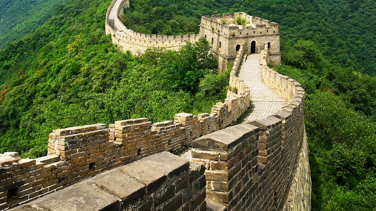
From the highly skewed A428 dual carriageway bridge near Highfields Caldecote in the west to the huge, grade-separated Hauxton junction in the east, EWR are proposing to build a Great Wall across rural south Cambridgeshire.
Because the taxpayer is not given a choice on the matter, this 16-kilometre long feature is barely mentioned in the 2021 consultation document, but it does emerge from a study of their long section drawings here and here. Aside from the massive visual impact and the noise, this feature could split communities that have stood for a thousand years. It could disrupt local travel patterns for school children and adults, destroy precious farmland and cause the protected Wimpole Barbastelles to move away.
The loss in local property values is already enormous and EWRCo.’s proposed blight policy will not even scratch the surface in terms of compensation.
We understand from EWR Co. engineers, that their key design driver is to maintain the speed of the railway. It follows that it needs to be straight and level where possible. This is to serve 100mph trains all the way from Oxford to Cambridge. But the forecasted number of people per train making this trip is only o.7 perhaps rising to 1.9 on average. [18,000 trips/year, 18 x 4 trains / day see 2019 EWR Co. Technical Report §4.11]. Can someone please explain the logic of this? EWR Co. tell us 75% of the traffic will be local and that they are surprised by this. If that’s correct why on earth has it not affected the design criteria? It looks like a symptom of a boondoggle. Please build something to serve the local demand – not a bullet train on a great wall.
Cross-Section of The Great Wall
The Great Wall is of course a railway embankment and we understand that their typical cross-section is as shown in fig.1 below.
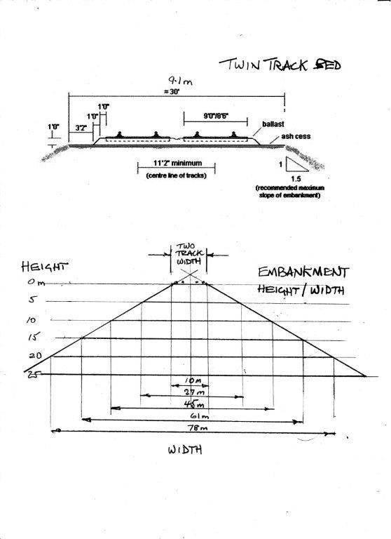
Looking at the long section diagrams linked to above we can see that the embankment height mostly in the range 5-12 metres. So we can expect the width at the base to be around 30 to 50 metres.
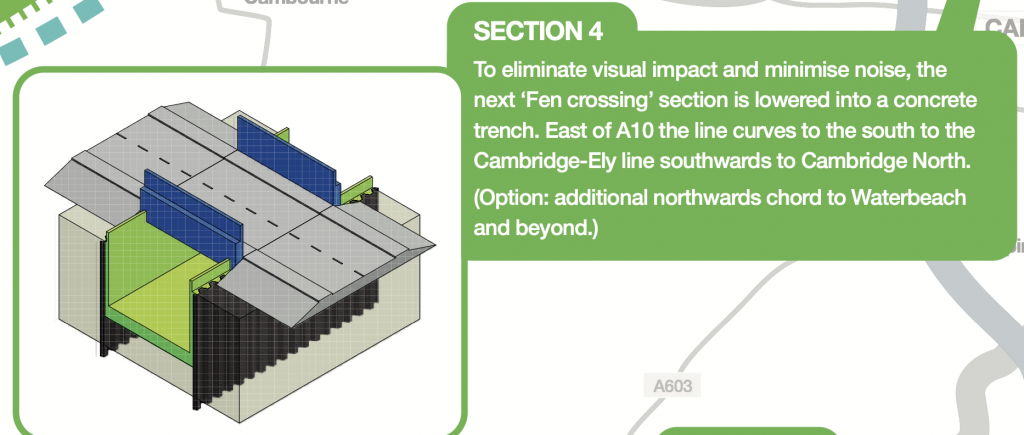
Our previous post on farmland impact assumed an 8m width. EWR Co are also reserving land either side of the Great Wall for construction access. We assume that the flatter land to the north of Cambridge would not need such high embankments. EWR Co. might also consider some innovation there by sinking the railway into a trench as proposed by cambedrailroad.org and shown in Fig.2
Photographer’s Impressions of The Great Wall
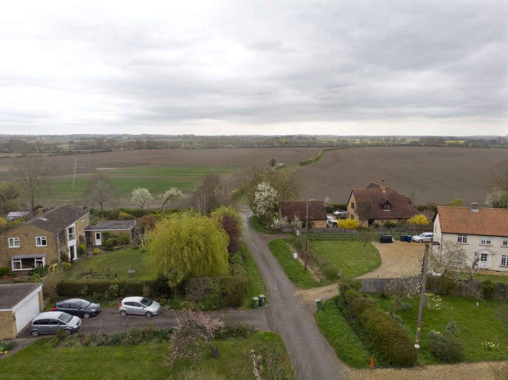
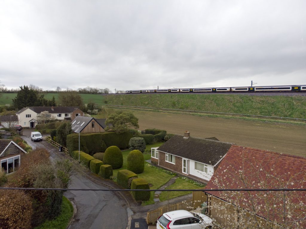
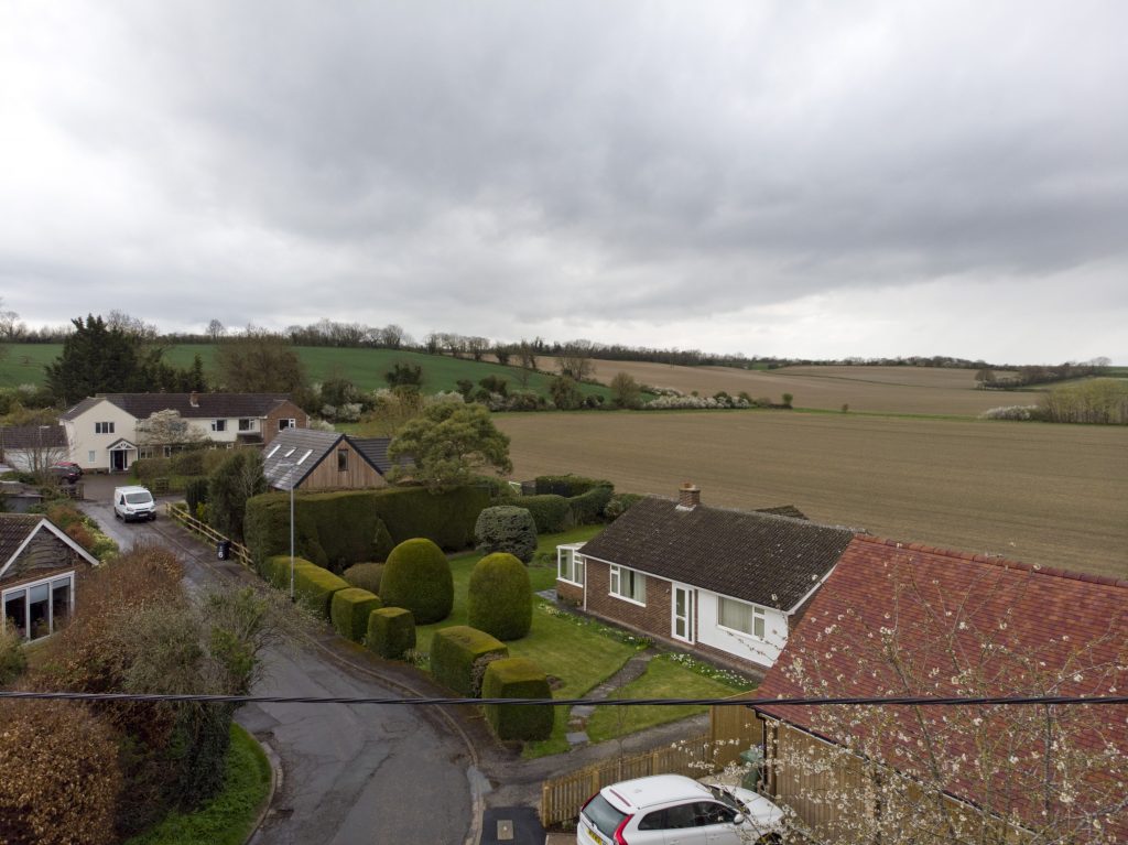
We asked a local photographer to create some impressions of what The Great Wall might look like in the section between Little Eversden and Haslingfield. These have been created from very recent photographs combined with railway embankments from elsewhere.
These mockups (figures 3, 5 & 7) are approximate but they do give an impression of what The Great Wall would be like. Also shown are the views from the same locations today (figures 4, 6 & 8).
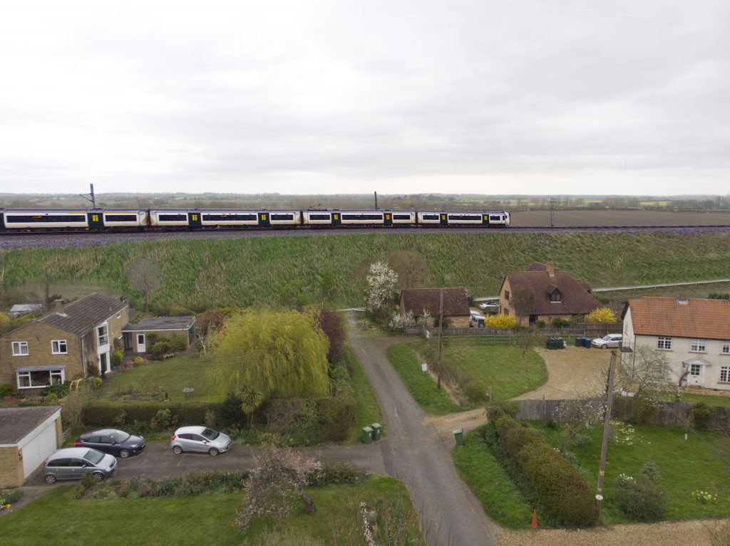


The West Anglia Mainline (WAML) at Clayhithe
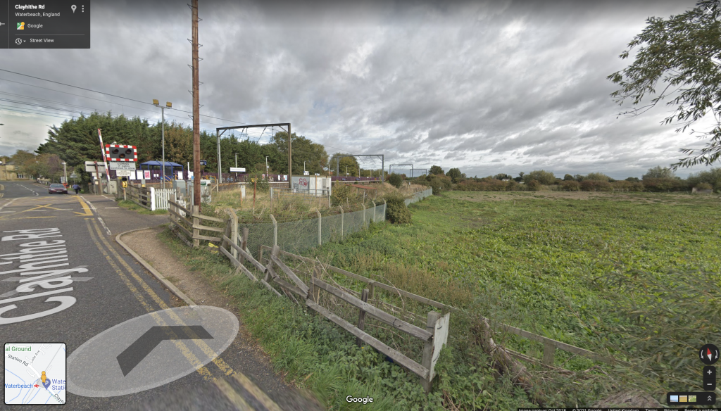
To get a feeling for the likely height of embankments required north of Cambridge here is a view (fig.9) of the existing WAML about 300m from the river Cam. It’s not easy to see but there is actually an embankment there. Notice also that the overhead lines are below tree height thus shielding the view from the houses behind them.
That’s not the end of the impact of this proposal by a long way, but it is enough for this post.
19 replies on “The Great Wall”
There aren’t enough expletives to scale this wall.
Thanks for this. However, would it be possible to rearrange the photos slightly and have the “with Great Wall”, and “before Great Wall” pictures together for each location? I think that would give me (and maybe others?) an even clearer sense of the impact this will have. Also, at Lowfields, that embankment is cutting right across the footpath that children, usually on bikes, use to get to Comberton Village College. Cutting it means they will have to travel on the A603 (currently no safe cycle path) or be ferried by car as going by bike means they can stay for extracurricular activities that are otherwise not possible if they travel on the school bus.
Thanks Sharon, good suggestion. I have re-ordered the photos as you suggested. I have also added a picture of an existing embankment at Clayhithe to the north of Cambridge on the West Anglia Mainline for comparison
This is such a good point from Sharon, the potential impact on cyclists sporting and recreational is huge. The road between Harlton and Haslingfield is an important road to criss cross over South Cambs and likewise Chapel Hill for North to South avoiding the A roads for Cambridgeshire cycle clubs (Cambridge, CTC, St Ives, Ashwell etc) EWR will push cyclists onto A roads where they are not usually accommodated for or very welcome. A roads are extremely unpleasant to ride on even if you are lit up like a Christmas tree, for children and teenagers it’s incredibly daunting and unsafe to have traffic pass you with varying closeness at speeds of 50 mph +
I have never seen a plan more ill-considered, more inappropriate to all local considerations, more illogical. This is simply amateur.
EWR need to start listening, and soon.
Aren’t you missing the fact that there will need to be access roads and points for servicing or emergencies; this would widen the bed of the railway and take more land out of production.
The consultation document isn’t at all clear on which roads crossed by the railway embankment would remain accessible to vehicles. I have written to EWR to request clarification regarding continued accessibility of various roads and public rights of way including the size of vehicles that will be able to pass.
Thank you for mocking up some visuals. I asked EWR last week at a webinar when they would be preparing 3D drawings. They replied that they would not be required until the statutory consultation. In my opinion this shows the importance that EWR place on the pre statutory consultation and the value they are placing on the feedback they will receive. The quality of responses from South Cambridgeshire communities will be only as good as the information EWR provide for the consultation process. The EWR pre consultation process appears flawed, or disingenuous in its communication of the proposed route. South Cambridgeshire villages have to rely on other sources, fortunately provided by Cambridge Approaches, to help people realise the impact of lines drawn on maps.
I’ve asked EWR for mock-ups to be presented during the upcoming consultation meetings. I have not had any feedback and I now gather I will be disappointed but not surprised. As you say it’s a demonstration of how little importance EWR put to the feedback. How on earth are we supposed to provide meaningful feedback when only selective information is provided.
To save anyone the bother of questioning why you might put a train in a trench through a flood zone, they use them in the Netherlands, where they know a thing or two about flooding.
Thank you for doing this work – really brings home the scale of the landscape violation – and where is all the material needed for these embankments going to come from??
I would imagine the northern route is much flatter so the visual impact far less ? And probably the sound pollution too – I would imagine the sound coming from 8 m up will spread a lot further than that at or below ground level and sheltered by potential tree cover? Hard to do at 8m+!!
Thank you so much for all the hard work the team has put into the campaign so far and these latest visuals of the terrible impact. We will be contributing to the war chest to stop this pointless monstrosity!
Excellent report. Just one issue: let’s show the longer, noisy freight trains that will use this line 24/7. Nuclear waste from Sizewell C anyone?
I’ve just copied and pasted this comment from CB Ind and it would be interesting to know why EWR will not consider the original track bed where it is still available. Most of it to Bedford is as far as i’m aware.
“The whole thing is pretty obvious really and as usual seems to lack any basic common sense.
The original Cambridge to Bedford railway track bed was built by the Victorians the same as the Cambridge to St Ives railway, which despite the nonsense spilled by the so called EWR spokesman, was built on a flood plain. The Victorians used these routes for a reason and they knew what they were doing and one of these two railways lasted 150 years before the County Council, Menzies CloWns & Co, ruined it by place thousands of tons of now falling to bits concrete. We told him and his circus but as usual he didn’t listen and they knew best. What’s happened now Bob? Oh yeah, one court action and another pending, with BAM Nuttall. Probs about £60m in total of court costs and a £50m overbuild costs on top of that? So, EWR should use the original Bedford to Cambridge route where possible and MAKE it possible where it isn’t possible. Move or run by the Telescopes at Lords Bridge. When you get to the M11 at Trumpington, from Barton, Haslingfield, down you go and tunnel it for an approach for Addenbrookes or cross and tunnel from Hauxton between the Mill and M11. This all saves you from ridiculously cutting through a massive hill and ruining prime countryside. Are you listening EWR? Of course you aren’t.”
Hear, hear. Good to see that I am not alone in thinking this. Obvious really. The Cambridge South Station is very close to the junction of the old railway (now the misguided busway). There must still be a civil engineering solution still open, so much better than the proposed route.
My submission in this round of consultation will be based on this or some other route close by. Thank you Chris.
Well said, I also cannot believe that the east west rail has taken such a ridiculous route just to include St Neots and Cambourne, when it should just follow the original route. No embankments, no cuttings, no viaducts.
Can someone provide some clarification on the cross section of the embankment suggested in the article. The embankment that carries the Kings Cross line between Royston and Meldreth appears to be much steeper, and therefore has a narrower footprint. Why is the suggested width greater than what we already have nearby ?
Has anyone notcied that EWR’s first online consultation is on Thursday? I have complained to them that both event 1 and event 2 are during the day at a time ‘regular’ working people cannot attend as they will be at work. Is this fair especially as most other regions have at least 1 evening session?
Letter from Anthony Browne received on 14 April mentions a ‘live chat’ session hosted by EWR at 1100 on 15 Apr-in fact now, as I write this.
I have hunted high and low, but have failed to find any reference to this elsewhere.
This is utterly typical of the cavalier disregard that EWR have displayed both to proper consultation and to transparency throughout. They keep referencing the 2019 ‘consultation’-neither I nor any of my neighbours recall any such event. The first I knew of this horrendous proposal was a CA leaflet drop last year.