A Report for Cambridge Approaches
Summary
East West Rail are planning to link Oxford and Cambridge by rail as part of the huge Ox Cam Arc development of new towns and villages.
A Consultation on the final route is open until 9 June.
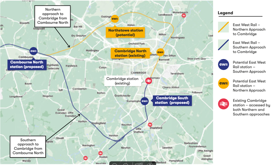
This new Report for Cambridge Approaches covers the wildlife and environmental impact of the two routes into Cambridge from Cambourne: the Southern Route, which EWR seem to have already decided on, and the Northern Fenland Route, which includes Northstowe and seems to be favoured by a majority of those affected by these proposals. The report shows the Southern route has much greater impact on wildlife and landscape.
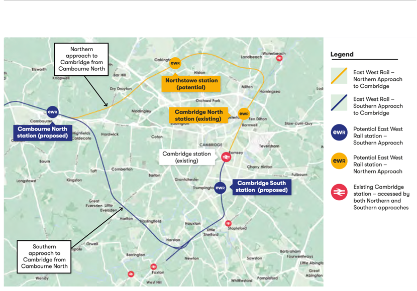
The Northern route is supported over the Southern one by every organisation involved in wildlife and landscape protection in the area, including the Bedfordshire, Cambridgeshire and Northamptonshire Wildlife Trust (BCNWT), the Woodland Trust, Cambridge Past Present and Future (CPPF) and the Countryside Restoration Trust. The government body charged with protecting nature, Natural England, has said “We are concerned at the apparent lack of an environmental justification for the discounting of route options to the North of Cambridge.”
It is important to note that the Consultation only asks people to consider the Southern route, not the Northern one. The route is only shown as a thin line on a map; it does not include the inevitable access roads, waste dumps, machinery parks and other infrastructure that will be needed nearby. It does not include impacts such as air pollution, noise and light pollution, toxic contamination, or changes to water quality and quantity.
Crucially it does not include any of the impact of the massive housing developments planned for the future. A stated aim of the Ox Cam Arc megaproject, of which this is a part, is to locate new development next to new transport infrastructure. One proposal, which has been put on hold for now at least, is for 25,000 homes (1), 5 times the size of Cambourne, in the Barrington area. Many other proposed new towns will follow, completely changing the character of the area and its villages. 1 million new homes are proposed within the Ox Cam Arc area by 2050 (one third of the total proposed for the whole of the UK).
East West Rail is already being dubbed Cambridgeshire’s own HS2.
If the project does go ahead, the environmental impact of the Southern Route will be much greater, and will have negative impacts on:
- Cambridgeshire’s internationally important chalk streams, with their populations of Brown Trout, Water Vole and Otter, and the River Cam itself, already severely under pressure from water extraction for other new developments. There are only 200 chalk streams in the world and five will be affected by the Southern route:
- The River Cam at Hauxton
- The Rhee or Cam at Harston
- The Riddy at Hauxton
- Coldhams Brook
- Hobson’s Brook which flows from the Nine Wells Local Nature Reserve into the city and beside the Botanic Garden, and was the first source of fresh drinking water for the people of Cambridge.
- The West Cambridgeshire Hundreds Living Landscape, where the BCNWT is linking ancient woodlands like Hardwick Wood that have survived for hundreds of years. The proposed route will form a barrier for wildlife, and for people from Cambridge and its many new developments, no longer able to walk and cycle from the city to explore these areas or the associated Cambridge Boulder Clay & Woodland Priority Area identified as part of the Cambridge Nature Network by BCNWT and CPPF.
- Our chalk hills and grasslands, one of the UK’s Priority Habitats, and in particular Haslingfield Chalk Pit and its associated landscape, which has thousands of orchids, including the nationally rare Man Orchid, and is widely valued and used by local communities.
- The Bourn Brook, a site internationally famous for its success in restoring rare water vole populations and reducing introduced American mink, and the work of the Countryside Restoration Trust at Westfield Farm, where over 20 years of research work have resulted in growing populations of rare farmland birds and plants.
- Many species of rare and endangered wildlife, including Barn Owls, Lapwings, Otters, Water Voles, Badgers and Bats. As just one example, the globally rare Barbastelle bat has a maternity colony centred on the Wimpole Hall estate and the Eversden Woods. This area has been awarded one of the UK’s highest levels of protection, a Special Area for Conservation. Feeding flights for the breeding mothers will be blocked, and bats may be killed, during the construction and operation of the Southern route. Many more less mobile mammals and birds will be greatly affected too. Mitigation for the Barbastelles suggested by EWR includes methods that have been shown not to work elsewhere, such as nest boxes and bridges(2).
- Elms are a rare tree in the British landscape, and recent research has found 35 species in Cambridgeshire(3), many growing in woods and hedges that will be destroyed, including one found nowhere else in the world, Ulmus cantabrigiensis, the Cambridge elm. Rare black poplars are also to be found along the southern route.
- As well as the Special Area for Conservation at Wimpole, the Southern route will destroy or damage 2 Sites of Special Scientific Interest (SSSIs), at least 11 County Wildlife Sites and 3 City Wildlife Sites, vitally important green spaces for the growing population of Cambridge.
The Northern route is much less damaging to wildlife and landscapes, as it would cross the area already affected by the A14 upgrade, and a small part of agricultural fenland. It would not need to cross the River Cam. It should not affect any SSSIs, one or possibly 2 County Wildlife Sites, and no City Wildlife Sites.
However, both routes are likely to damage Coldhams Common and Coldhams Brook with its associated chalk stream network, a key recreational and wildlife site for the people of Cambridge. A large loop will need to be built here to allow freight trains to wait for a path through Cambridge; there has been little discussion about this major impact.
The rest of the Report gives more details on the impacts.
The author is:
Kevin Hand MSc MCIEEM
Independent Ecologist
Vice President, Cambridge Natural History Society
Course Director, ACE Foundation and Stapleford Granary
References
- Brackley, P. (2020). Why Thakeham’s plans for 25,000 homes in South Cambridgeshire will still be considered for the Local Plan. https://www.cambridgeindependent.co.uk/news/why-thakeham-s-plans-for-25-000-homes-in-south-cambridgeshire-will-still-be-considered-for-the-local-plan-9144678/
- Sutherland, W.J. & Wordley, C.F.R. (2017). Evidence complacency hampers conservation. Nature Ecology & Evolution 1, 1215–1216.
“The second example is that of bat gantries (pictured), designed to reduce bat mortality on roads. Gantries, which are meant to guide bats to fly high enough over roads to avoid traffic mortality, were used in the UK for nine years without being tested, at a total cost of around £1 million. When studies were eventually undertaken, they found the gantries to be ineffective yet gantries continue to be constructed. Again, this is not due to a lack of available evidence, nor even to awareness of existing evidence; the gantry studies were widely reported in the national press, in relevant conferences and on television.”
3. Wildlife Trust BCN (2019). Here and Nowhere Else. https://www.wildlifebcn.org/blog/wildlife-trust-bcn/here-and-nowhere-else.
Main Report
1. Chalk Streams
There are only around 200 chalk streams left in the world and 85% of them are in southern England.
The unique characteristics of chalk streams, with their pure cool water, support a wide range of flora and fauna, from plants such as Water-crowfoot, Lesser Water Parsnip and Water Starwort, to a diverse collection of invertebrates and fish including the iconic Brown Trout. A chalk stream teeming with life is also attractive to Water Voles, Kingfisher and Otter. The unique and diverse ecology of chalk streams makes them a globally rare, and globally important, habitat. It could be argued that chalk streams are our local equivalent of rainforests.
The chalk streams affected by the SOUTHERN ROUTE are detailed in the recent Greater Cambridge Chalk Streams Project Report produced for Cambridge City Council and Cambridge Water by Ruth Hawksley at the BCN Wildlife Trust and Rob Mungovan of the Wild Trout Trust(1).
Five chalk stream sites will be affected by the SOUTHERN ROUTE, namely:
- The River Cam at Hauxton, which has Otter, Brown Trout and Brook Lamprey, a rarely seen and ancient fish which lives most of its life without eyes or mouth.
- The Rhee or Cam at Harston, also with Otter and Brown Trout.
- The Riddy at Hauxton.
- Coldhams Brook, which has Water Voles and Otter, both unusual in an urban environment.
- Hobson’s Brook which flows from the Nine Wells Local Nature Reserve (LNR) into the city and beside the Botanic Garden, and was the first source of fresh drinking water for the people of Cambridge. Nine Wells LNR is a County Wildlife Site (CWS), and was formerly a Site of Special Scientific Interest (SSSI). It is also part of the Gog Magog Countryside Project connecting it with Wandlebury.
Brown Trout are just starting to return to the area as water quality slowly improves. Otters are a protected species under the Wildlife and Countryside Act 1981, also returning after an absence of many years. Water Voles are also protected under the Wildlife and Countryside Act 1981. They are one of our fastest declining mammals, but are also present in good numbers. Both are found in all 5 of the chalk streams that will be affected.
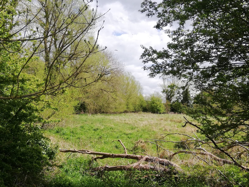
Beside the Rhee, at the SOUTHERN ROUTE crossing point, is a complex of wet meadows and wet willow woodland, probably the rarest UK woodland type. Both are Priority Habitats. This area would qualify as a CWS on its own merits. The author noted breeding evidence of Cetti’s Warbler here, probably a new county record, and singing Grasshopper Warbler. The woodland and associated mature willows have potential as a breeding site for the endangered Lesser Spotted Woodpecker.
The national Chalk Stream Alliance is fighting to protect the remaining streams. Locally the Cam Valley Forum (https://camvalleyforum.uk) is working to combat threats such as this kind of development. On 21 June 2021 the Friends of the River Cam are launching the Rights of the River Cam.
The NORTHERN ROUTE does not affect any chalk streams, and does not affect the River Cam, except in that both routes can impact Coldhams Brook and Coldhams Common by building a loop of track there so that large freight trains can turn around. This could be avoided if a loop is built outside Ely instead.
All the streams and river sections listed are going to be affected by the SOUTHERN ROUTE. Particular damage can be done during the building works by things such as increased sediment load, pollution and the disruption of hydrology. Noise and light pollution disturbing breeding birds and mammals would also be a particular issue.
Otters are fully protected under the Wildlife and Countryside Act 1981. They are highly secretive when breeding, and cover a wide area, often up to over 35km of riverbanks, so laws protecting them could easily be broken. All nesting birds are protected, again under the Wildlife and Countryside Act 1981, so no work could be done during the breeding season, from at least March-July, without breaking the law. No licences are available to destroy or disturb birds’ nests. Special species, like Kingfisher and the wetland warblers present such as Sedge, Reed and Cetti’s, have nests that are particularly hard to find.
2. Hardwick Wood and the West Cambridgeshire Hundreds Living Landscape
(A) Hardwick Wood
This is an ancient ash and field maple woodland, with nationally rare Oxlips (Primula elatior), and is managed by the Bedfordshire, Cambridgeshire and Northamptonshire Wildlife Trust (BCNWT) as a nature reserve. Recent changes to the National Planning Policy Framework for England planning laws state that “ancient woodland should not be affected by any development”. It is also a Site of Special Scientific Interest (SSSI), often referred to as the Crown Jewels of nature sites in Britain, and specifically protected by planning laws.
“Hardwick Wood has the sinuous outline of medieval woods and is surrounded by a substantial wood bank, well preserved on the south and east sides. After ceasing in the early 20th century, coppicing was reinstated in 1979. This traditional practice lets in more light to the benefit of flowers and insects. As the coppice grows it provides safe nesting sites for woodland songbirds such as willow warbler, marsh tit and blackcap. The large amount of dead wood is a boon for the woodpeckers that can be heard drumming in spring. The Mere Way runs along the western boundary, the banks of the adjoining ditch providing a haven for cowslips and the rare crested cow-wheat, usually found on the margins of ancient woodlands and in clearings and rides. As twilight descends, the hoots of owls can be heard and bats patrol the woodland edges in their search for food.”
Source: https://www.wildlifebcn.org/nature-reserves/hardwick-wood
(B) Impact
The SOUTHERN ROUTE does not cut directly through the Wood, but goes close enough to have a significant impact on it, especially during the construction phase. It will also cut through wildlife corridors associated with the Wood, reducing its wildlife value. As there is no indication where associated works will be, it may be that access roads, waste dumps, spoil pits etc have further impacts upon the Wood and its associated habitats. As such, it will impact on the West Cambridgeshire Hundreds project.
(C) The West Cambridgeshire Hundreds
These are a collection of wildlife-rich ancient woodlands in an area defined for over 1000 years by the old Anglo-Saxon regional divisions known as the Cambridgeshire Hundreds. It’s thought the word ‘hundred’ came from an area of land that could supply 100 warriors in times of war.
This is a joint project between the BCN Wildlife Trust, local landowners, the Farming and Wildlife Advisory Group East, the National Trust, Natural England, the Forestry Commission and the Woodland Trust. The Scheme area extends to 20,000 Ha.
The SOUTHERN ROUTE may also impact two nearby County Wildlife Sites (CWS). CWSs are areas of land in Cambridgeshire important for their wildlife, selected by the combined expertise of the BCN Wildlife Trust, Farming and Wildlife Advisory Group, Natural England, Environment Agency, local authorities and the Cambridgeshire and Peterborough Environmental Records Centre (CPERC).
- Jason Farm Grassland CWS is just north-west of Hardwick Wood. This site is notified because it has 0.05ha of the National Vegetation Classification (NVC) community MG5 Crested Dog’s-tail (Cynosurus cristatus)) – Black Knapweed (Centaurea nigra) grassland.
- Frogs Hall Drift CWS is south of Hardwick Wood and supports frequent numbers of at least eight neutral grassland indicator species and populations of Nationally Scarce vascular plant species (Sulphur Clover (Trifolium ochroleucon); Yellow Pea (Lathyrus aphaca); Slender Tare (Vicia parviflora); Purple Fescue (Vulpia ambigua ssp. Ciliata – taken from CPERC records)).
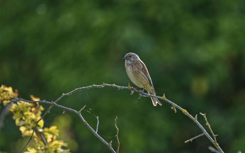
The author found breeding evidence of Corn Bunting (Emberiza calandra), Skylark (Alauda arvensis), Yellowhammer (Emberiza citronella) and Linnet (Linaria cannabina) in the area. All are classified as Red under the Birds of Conservation Concern 4: the Red List for Birds, and are Priority Species under the UK Post-2010 Biodiversity Framework.
(D) Cambridge Nature Network
BCNWT, working with Cambridge City Council and others, have identified the landscape west of Cambridge as having significant potential to connect Cambridge to the West Cambridgeshire Hundreds, for the benefit of wildlife and people.
“The EWR favoured Southern route from Cambourne to Cambridge fundamentally compromises this goal of creating landscape scale connections … in this part of Cambridgeshire in providing a pleasant and largely undeveloped green lung accessible to the people of Cambridge.”
Source: https://www.wildlifebcn.org/news/east-west-rail-consultation
“The proposed route will in effect form a barrier for some wildlife and most definitely for people between the West Cambridgeshire Hundreds and the Cambridge Boulder Clay & Woodland Priority Area identified as part of the Cambridge Nature Network. The barrier will also separate the people of Cambridge from the West Cambridgeshire Hundreds, in that attractive non-motorised travel routes will be severely degraded or even cut off.”
Source: Martin Baker, Conservation Manager, BCNWT
3. Chalk Hills and Grassland
Cambridgeshire’s ridge of chalk hills, running here from Wimpole to the valley of the Cam at Haslingfield, are a highly visual highlight of the county’s landscape. They were formed in the Cretaceous period between about 90 and 99 million years ago, mostly from the remains of marine algae and various animals that sank to the bottom of a warm, deep sea. Rain filters through them to feed the chalk streams, and their aquifers supply much of our drinking water. Chalk grassland is only found in north-west Europe, and a significant proportion of this is in the southern counties of England. Chalk grassland has declined by an estimated 75-80%since the Second World War.
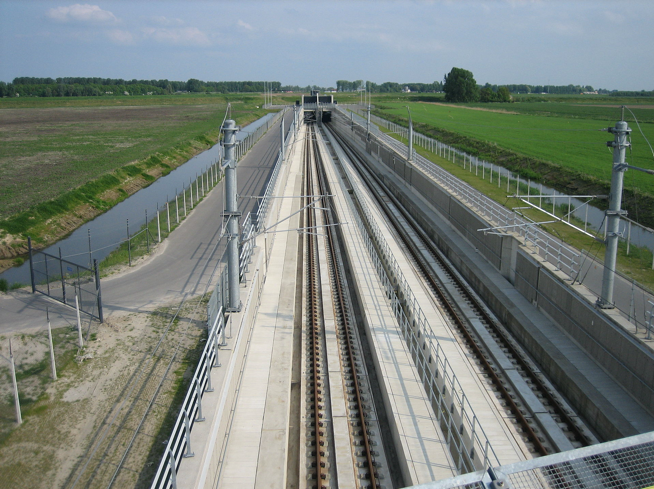
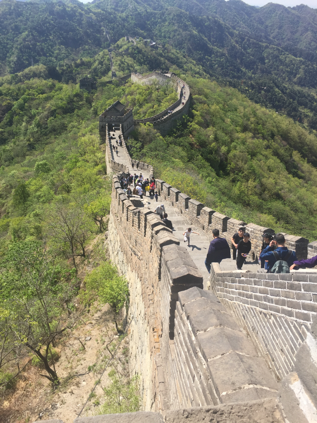
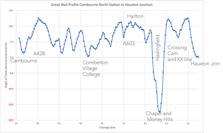
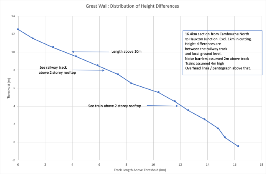
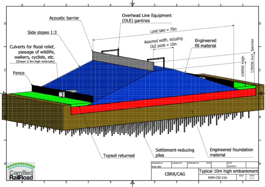
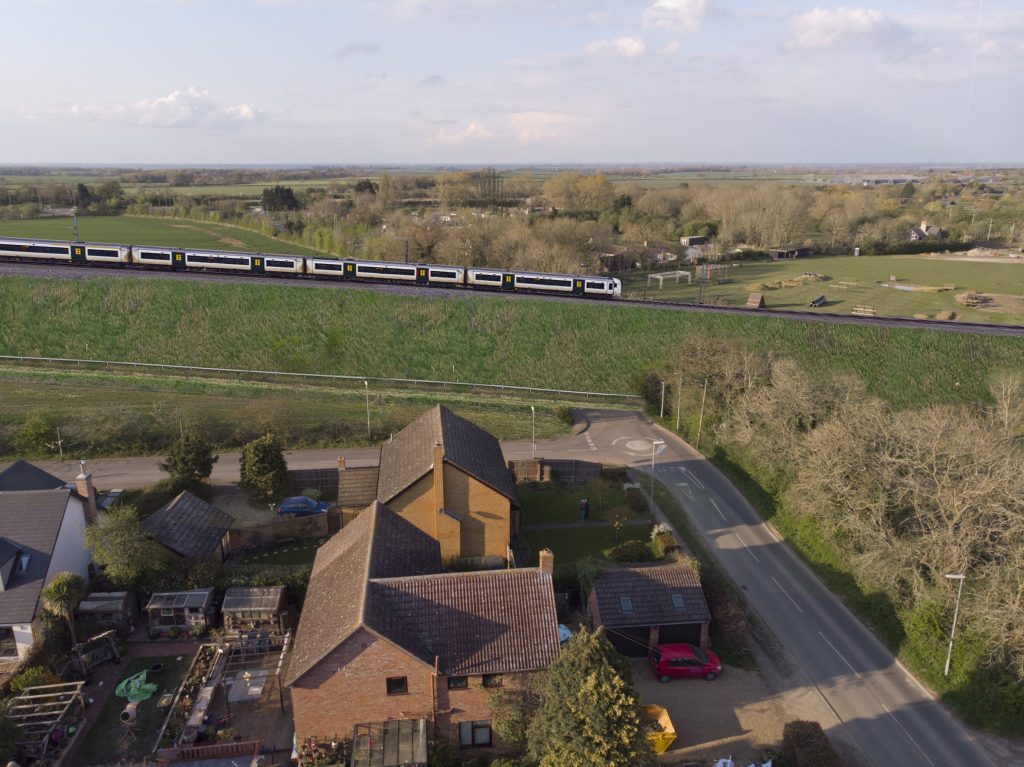
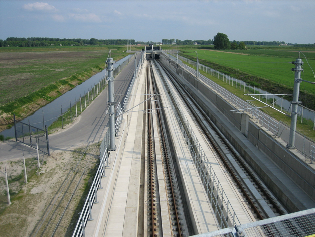
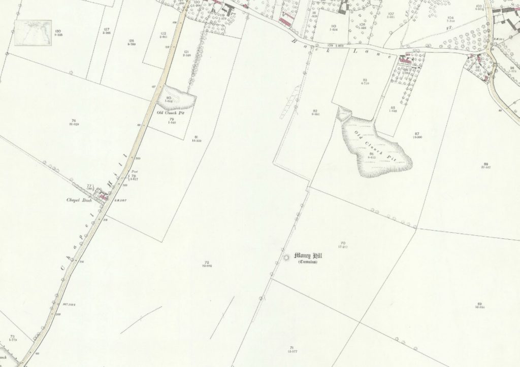
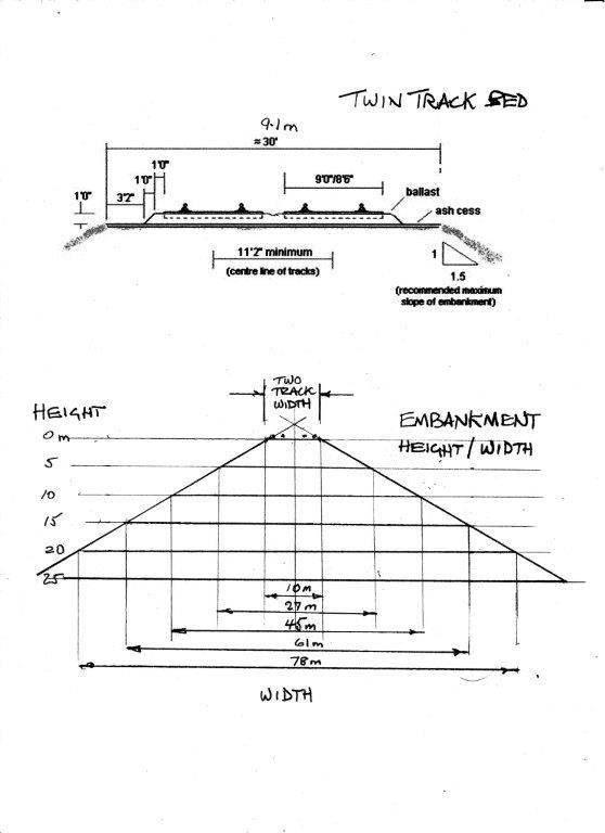
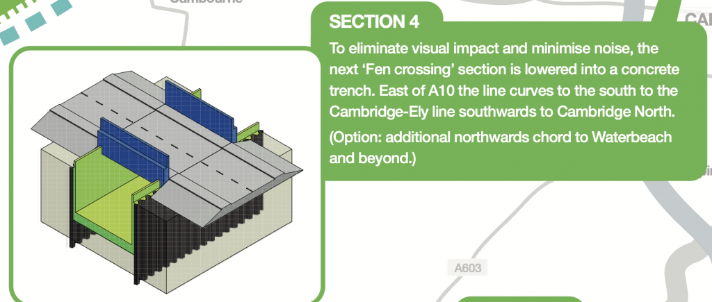
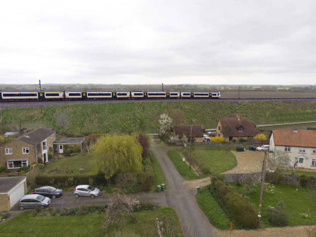
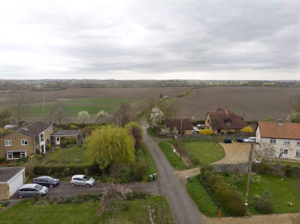
The SOUTHERN ROUTE from Cambourne to Harston contains a huge embankment, viaduct and cutting complex dubbed the Great Wall of Cambridge, which will transform the landscape. This route will cut through the chalk hills from Harlton to Harston, and will include a deep cutting through the historic Chapel Hill, the famous ridge that stands above the village of Barrington. Once changed, this landscape can never be restored.

The chalk soils form another Priority Habitat under the UK Biodiversity Action Plan and the Natural Environment and Rural Communities Act. The roadside verges at Chapel Hill are rich in chalk flowers, and should qualify as a County Wildlife Site.
Nearby Haslingfield Pit is a CWS, notified because of the thousands of rare orchids that grow there, in particular the Man Orchid, listed as Nationally Scarce. Other orchids include Common Twayblade, Bee Orchid and Common Spotted Orchid. They are counted annually by local volunteers led by Clive Blower. In 2017 the totals were:
- Man Orchid (Orchis anthropophora) – 75
- Bee Orchid (Orphrys apifera) – 12
- Common Twayblade (Neottia ovata) – 606
- Common Spotted Orchid (Dactylorhiza fuchsia) – 1515
Haslingfield Pit is widely used for recreation and relaxation by locals and visitors. It has the potential to expand into neighbouring areas, including the field margins nearby, which also potentially hold rare chalk flowers.
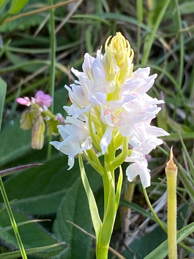
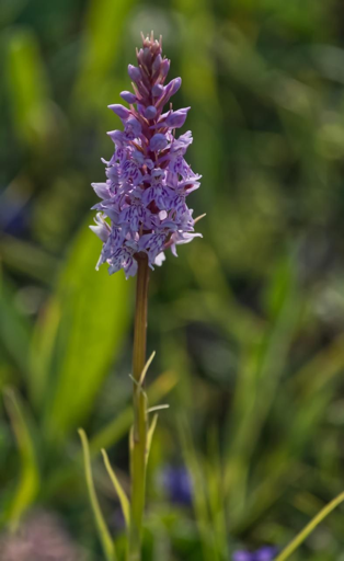
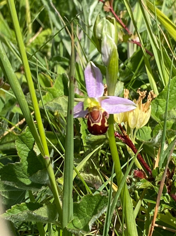
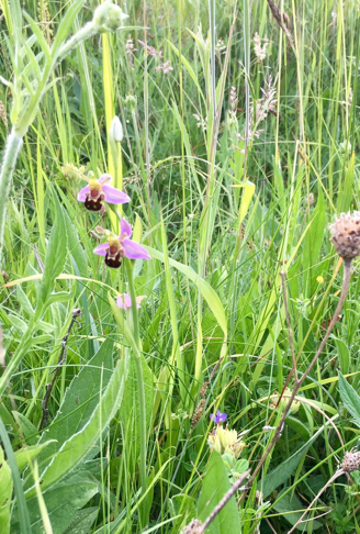
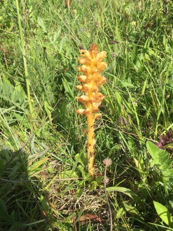
Also likely to be affected by the SOUTHERN ROUTE is the nearby Barrington Chalk Pit SSSI. This is a ‘Geological Conservation Review’ site, and is noted as the last remaining exposure of the famous Cretaceous ‘Cambridge Greensand’. The site has great stratigraphical importance for studies of the Upper Cretaceous of eastern England.
The area is also noted for its wildlife interest, with protected species such as Peregrine Falcon (Falco peregrinus) and Raven (Corvus corax) nesting nearby, and many rare elms growing in the hedges.
4. Bourn Brook, the Countryside Restoration Trust land at Westfield Farm, Comberton, and nearby County Wildlife Sites
(A) Bourn Brook
Bourn Brook is part of the same network as the chalk streams that flow into the Cam, but is classified as a clay stream as it runs mainly beneath the chalk hills, all the way into the outskirts of Cambridge at Byron’s Pool, Grantchester. The SOUTHERN ROUTE will cross it south of Toft, with a huge potential impact on its wildlife and ecology.
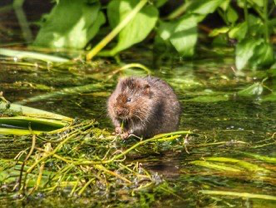
Bourn Brook is internationally famous for its Water Vole conservation work, led by Dr Vince Lea and the Countryside Restoration Trust (CRT). Their project to eradicate introduced American Mink, Bourn Free, has been widely publicised and admired for its ground-breaking success. As a result, Water Vole numbers have increased such that every available habitat along the Brook is now occupied, with a similar increase in water birds and particularly Otters. Otters are rarely seen so their numbers are estimated by the number of spraints (droppings marking territory), which increased from 11 in 2011 to 90 in 2017. The project is described in detail in an article by Dr Lea(2) in British Wildlife in December 2020. Water Voles can, in theory, be moved elsewhere from a site that is threatened with destruction, when Natural England give developers a licence to do this, except that all suitable habitat nearby is already occupied. Otters cannot be subjected to licensed removal, and there is no mitigation possible for the thriving populations living here.
Otter and Water Vole conservation is just part of the work of the Countryside Restoration Trust, whose Westfield Farm at Comberton will be cut in half by the SOUTHERN ROUTE. The CRT statement on this gives an excellent overview of the impacts on the wildlife of the area, and we quote extensively from it here.
“ The latest preferred route option is potentially disastrous for nature and wildlife habitats in the Cambridge area.
The rail link’s proposed route will directly and negatively impact wildlife habitats and species numbers and divide habitat corridors throughout the area. The route could destroy 27 years of endeavour to increase national declining species on CRT land at Westfield Farm in Comberton.
We have been approached to have environmental studies on our land at Westfield Farm, Comberton, in 2021. The East-West Railway project has recently released an interactive map showing the route in a blue-grey proposed area (and layers of land designation can be highlighted).
Westfield lies south-west of Comberton, and despite being listed as a ‘Priority Habitat’ (by Natural England) and a Greenbelt area (by The Ministry of Housing, Communities and Local Government’s formerly the Department for Communities and Local Government) which is specially designated area of countryside protected from most forms of development, the route dissects through the land.
The concern is that this devastates CRT land and other habitats, reserves, and local homes. We join other organisations suggestions that the railway line should follow the A428 and not obliterate the precious rural countryside to the west of Cambridgeshire.”
Source: https://www.countrysiderestorationtrust.com/oxford-cambridge-arc
(B) Westfield Wildlife
Again, quoting extensively from the CRT statement, and using their images, we note the extensive number of species that will be impacted by this development.
“We are extremely concerned about the impact the East-West Railway project will have on the habitats of protected, rare and farmland species. These include many BAP species identified as being the most threatened and requiring conservation action under the UK Biodiversity Action Plan (UK BAP).
- Birds
- Yellowhammer (in the top 1% of sites nationally 2019)
- Grey partridge (in top 1% of sites nationally 2019)
- Corn Bunting (numbers in the top 10% of sites nationally 2019)
- Skylarks (numbers in the top 10% of sites nationally 2019)
- Linnet
- Song Thrush
- Barn Owl
- Kingfisher
- Starlings
- Hobby (rare migratory falcon – spotted 2020)
- Lapwings (winter visitor)
- Golden Plover (winter visitor)
- Mammals
- Brown Hare Priority Species under the UK Post-2010 Biodiversity Framework
- Badger Sett (Under the Protection of Badgers Act 1992)
- Pipistrelle bat
- Barbastelle bat
Large numbers of Brown Hares on-site, with double-figure counts regularly seen. Brown Hares are listed as a Priority Species under the UK Post-2010 Biodiversity Framework.
At least one Badger sett with activity in other areas suggesting possibly a secondary sett developing. It is against the law, under the Protection of Badgers Act 1992, in England and Wales to disturb a badger and intentionally or recklessly damage or destroy a badger sett or obstruct access to it.
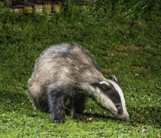
Bats are not systematically recorded but are seen, Pipistrelles particularly. Also, there are recorded sightings of the Barbastelle bat.
In 2020 we undertook our first Harvest Mouse nest exploration on Westfield and found a nest, demonstrating that this species is present on site.“
(C) Bourn Brook through Westfield, reptiles, butterflies and plants
Again, we quote extensively from the CRT statement on the biodiversity present.
“The Bourn Brook’s riparian habitat that runs through Westfield is regularly monitored and maintained to create habitats for declining species and remove invasive species.
Water Voles have colonised the site following work on the Bourn Brook to remove the invasive American Mink. Through a collaborative project, started in 2011, called the Bourn Free project, the local numbers of Water Vole has risen on other parts of the Bourn Brook that flows through Lark Rise Farm, CRT land in Barton.
Westfield was the site where the first live-sighting of a wild, native Polecat was made in Cambridgeshire when one entered one of our mink traps and was released back into the wild following photographs as a record of the sighting.
Grass snakes are seen in most years, including one record in 2020. These reptiles are listed as a Priority Species under the UK Post-2010 Biodiversity Framework.
Great Crested Newts have been recorded on a few occasions. Great Crested Newts are listed as a Priority Species under the UK Post-2010 Biodiversity Framework.
There is a regular survey of butterflies on the site, with nearly 20 years of data fed into the national butterfly monitoring scheme. This long-running data set would be threatened if a railway line crosses the site.
While most species recorded are common and widespread, we have a good assemblage of species, including Small Coppers, Marbled Whites and Purple Hairstreaks.
In recent years, the Biodiversity Action Plan Species White-letter Hairstreak has been recorded with photographic evidence.
Many rare and scarce arable weeds have been recorded on Westfield.
An example of some of the arable weeds include:
- Shepherd’s Needle
- Sharp-leaved Fluellens
- Night-flowering Catchfly
Restored hay-meadows now have naturally colonised by Pyramidal Orchids recorded among other species.”
Source: https://www.countrysiderestorationtrust.com/oxford-cambridge-arc
(D) Other County Wildlife Sites
Near to Westfield Farm are another two County Wildlife Sites that will be impacted:
- The Radio Telescope area west of A603
This supports over 0.05ha of the NVC community CG3 Upright Brome grassland.
- Lords Bridge Observatory
Situated east of the A603, this supports frequent numbers of at least 3 strong neutral grassland indicator species. Additionally it supports a population of the Nationally Scarce vascular plant species Slender Tare (Vicia parviflora). It is a large site at 34 ha.
The sides of A603 here are Protected Road Verges for similarly valuable neutral and calcareous grassland.
5. Endangered Wildlife, including Barbastelle bats
Many species of endangered and protected wildlife will be killed by the SOUTHERN ROUTE. Most of these are listed under their sites mentioned above.
In addition the route includes good populations of Water Vole, Otter, Brown Hare, Badgers and Bats. The last two are dealt with in more detail below. Rare species such as Marsh Harrier, Red Kite, Raven and Peregrine Falcon breed along the route: their locations are not publicised. Barn Owls nest in many places along the route, as do Grey Partridges, Skylarks, Yellow Wagtail, Lapwing, Yellowhammers, Bullfinch, Dunnock, Reed Bunting, Song Thrushand Linnets, all Red List farmland bird species of conservation concern. There are good populations of Whitethroat, Blackcap and Chiffchaff, and smaller numbers of Willow Warbler, Lesser Whitethroat, Sedge Warbler and Reed Warbler, as well as many other scarce bird species that use the many hedges and woodland strips along the route.
All birds and their nests have protection under the Wildlife and Countryside Act, with no Natural England licences available to exempt developers from the unlimited fines available for nest disturbance or destruction. This means all work should stop whenever birds are nesting, roughly half the year, adding considerably to the time needed to complete the project.
The NORTHERN ROUTE also has nesting birds, but overall the numbers are likely to be less, with fewer species of special importance, particularly as much of the land is urban, suburban, already developed, or intensively managed farmland with few hedges and woods. Badgers do occur in reasonable numbers in the Dry Drayton area, but much less so on the drained fen farmland. Bats are likely to show a similar distribution, but more work should be done to confirm this. Otters are likely to be absent from the route, and Water Voles extremely scarce.
(A) Bats
All bat species are scarce and endangered, with some being our rarest animals. All are protected under the Wildlife and Countryside Act 1981, along with their roosts in trees and buildings. As with all the other wildlife recorded, it is likely that bat numbers affected are much greater along the SOUTHERN ROUTE. Many will roost in mature trees that will be felled, particularly Noctule, Long Eared and the two Pipistrelle species, with others roosting in woods, and for the last three species, some of the houses that will be destroyed.
The UK is a signatory to the Agreement on the Conservation of Bats in Europe, set up under the Bonn Convention. The Fundamental Obligations of Article III of this Agreement require the protection of all bats and their habitats, including the identification and protection from damage or disturbance of important feeding areas for bats.
It is worth noting that bat roosts are notoriously hard to find. Many developers employ ecologists who will survey for bat roosts. This involves waiting beside potential roost trees at dusk or dawn, with audio bat detectors, in the hope of seeing or hearing the very fast emergence of the bats, which takes a matter of seconds. It is easily missed. With so many trees to look at it is highly unlikely that all bat roosts will be found before tree felling begins.
(B) Barbastelles (Barbastella barbastellus)
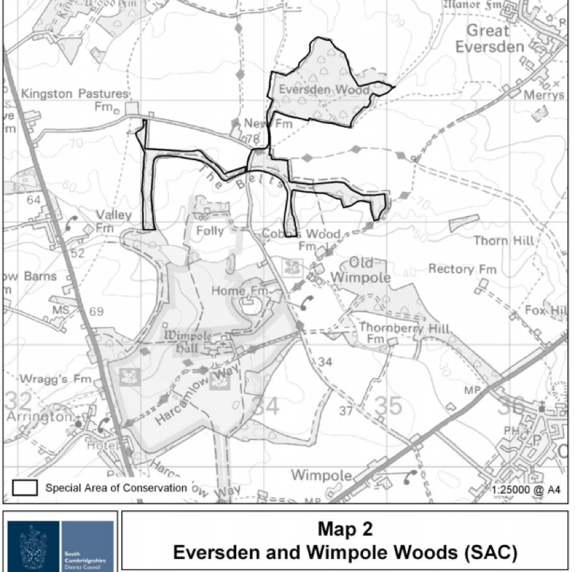
Of particular importance, South Cambridgeshire is home to a large breeding colony of one of our rarest bats, the Barbastelle. The Wimpole Estate and Eversden Woods are protected for this reason with one of the highest UK designations, a Special Area of Conservation (SAC) https://sac.jncc.gov.uk/site/UK0030331
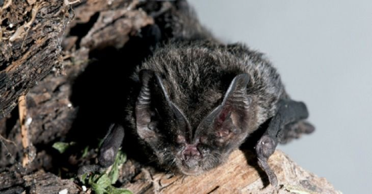
Although the works associated with the SOUTHERN ROUTE will hopefully not destroy this area directly, Barbastelles feed at traditional sites some distance away in rural landscapes with deciduous woodland, wet meadows and water bodies. Barbastelles tolerate only minimal disturbance within 2 km of their roost. They can forage up to 20km from their roosts but more typically venture around 6-8km. They commute to foraging sites along linear landscape features, such as woodland edges and hedgerows, similar to the hedgerows that act as wildlife corridors. They have also been known to cross open areas such as arable fields to reach foraging grounds.
In 2008, a proposal for 8 wind turbines on land at Merry’s Farm, Great Eversden, was put to the landowner but not carried out because Natural England stated that “Separate to any Environmental Impact Assessment undertaken there will also need to be an Appropriate Assessment for the proposal under the Habitats Regulations. For the proposals to pass this assessment it will have to be conclusively shown that there will be no impacts on the integrity of the site (i.e. on the barbastelles for which the site is designated) arising from the development. If there is any
uncertainty about such impacts, then the proposal is unlikely to pass the assessment.”
In addition “given the international importance of the site and the acknowledged deficiencies in current scientific knowledge, we would also expect to see more innovative methods of survey employed to detect activity at turbine height (e.g. using remote systems or radar). In order to provide a robust evidence base to meet the requirements of an AppropriateAssessment, we would suggest that at least 3 years worth of survey data would be required.”
Source: This information has been shared with CA by Jane Rolph of Merry’s Farm.
The same level of compliance must be needed for the railway and its ‘Great Wall’ viaduct and all other associated works. Three years of intensive survey would significantly delay the project and increase the costs, and the results may well mean this route is rejected.
Disruption to the foraging routes and flight lines could have a potentially significant impact on the Barbastelle bats foraging habits, particularly impacting on the breeding females, putting at risk the maternity colony and, thus, ultimately the species. The species is very sensitive to disturbance, including disturbance to roost sites and access to food resources, which may be why it is such a rare bat. The Barbastelle is on the International Union for Conservation of Nature’s Red List of Threatened Species, where it is classified as ‘near threatened’ with extinction (IUCN Red List 2020).
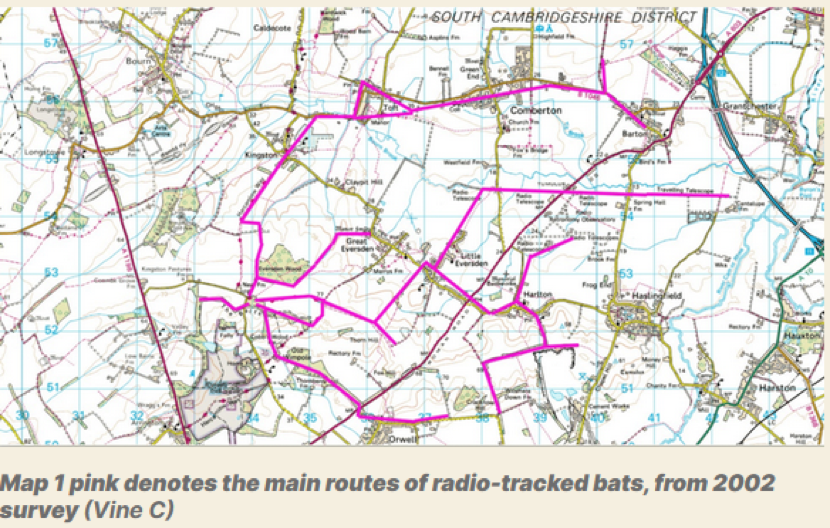
Much radio tracking work has been done on the areas the breeding bats use when feeding their young, and many of these lie directly along the planned works. Other areas are the other side of the route, and there is good evidence that bats cannot cross these kind of large transport routes, and risk death if they try. The gantries proposed by EWR have been shown not to work see Sutherland & Wordley, 2017(3).
Damant & Vine (2006)(4) stated the following:
“After another hour or two these bats would make excursions to the east, towards Cambridge. The favoured route for some bats was the old railway line with the radio telescope dishes; this also had tall neglected hedges either side and semi-natural grassland (another good source of micro-lepidoptera). Other routes were along Bourn brook and other tall hedges. The small villages of Toft, Kingston, Comberton, Barton and Harlton were also favoured. In 2003 one bat used Harlton quite frequently, including the old chalk quarry with its secondary growth of woodland and the tall hedges in and around the area.
… The Barton area was extensively used by a single bat which sometimes flew to Barton, back to the maternity roost woodland and back to Barton in one night. It is very probable that these trackways are used because of the natural grassland margins, their quietness and also the fact that they may actually accumulate wind blown invertebrates from the surrounding arable land. Simon Damant has witnessed this in another trackway used by Pipistrelles where a short section had a tall hedge in a predominantly open landscape a long way from buildings and woodland.
… To some extent the Wimpole population follows this basic assumption in that they do use Bourn Brook and go into Grantchester where the River Cam joins the River Rhee, almost certainly relying on the adjacent meadows to the waterways for a rich source of food. The small River Rhee catchment and Bourn Brook seem to be the main areas for foraging, though villages to the east are also frequented. However, in a much modified human landscape the bats would seem to have also adapted to using the more unkempt wider and taller boundary hedgerows with woodland copses for their flight lines and foraging in south west Cambridgeshire. They have also used the disused railway lines which have developed a secondary tree growth and tall hedgerows with semi natural grasslands. It is important to note that southwest Cambridgeshire is well wooded compared with much of the rest of the county but even here woodland is sparse and not particularly well linked by good tall and wide hedgerows.
… Therefore absolutely any woodland loss within a radius of 10-15km could be of great significance for the viability of the population of Barbastelles at Wimpole.”
It is recommended by the Conservation of Habitats and Species Regulations 2017 that large infrastructure projects that could impact an SAC, whatever the distance, should undertake a Habitats Regulation Assessment. This has not been done, for either route. The Habitats Directive includes protection of the habitat, including the flight and foraging lines upon which the bats rely to successfully breed and rear young. Natural England have stated: For this reason, Natural England would advise that an Evidence Plan should be agreed with the relevant statutory bodies in order to inform EWR Co.’s approach to complying with the Habitats and Wild Birds Directives.
Source: Natural England response to the non-statutory consultation 2019, page 254.
Much has already been written about the impacts of the SOUTHERN ROUTE on the Barbastelles of Wimpole and Eversden. There is an excellent article by Angela Thompson, Chris Vine, Pippa Keynes and William Harrold on the Cambridge Approaches website. Source: https://cambridgeapproaches.org/barbastelle-bats-are-they-important-when-considering-ewr-route/
This draws on the work of the Cambridgeshire Bat Group in radio tracking barbastelles from the SAC maternity colony (Vine 2002)(5). This showed their flight and foraging lines include the Bourn Brook corridor and the River Rhee/Cam, as well as the two CWS sites at Lords Bridge and the Radio Telescope line.
Note that this work would need to be brought up to date by EWR before they could make any suggestions of mitigation, tunnels or gantries, even though these have been shown not to work.
(C) Badgers (Meles meles)
Badgers are abundant along the Southern Chalk Hills route. The Cambridgeshire Mammal Group are aware of at least 20-30 family groups that will be impacted, and note that many more families are unrecorded. These families can have over 30 members. The average is 5- 8 adults per family, plus young, so an estimated 150 badgers at least could be affected, perhaps over 500.
Many fewer badgers will be affected by the NORTHERN ROUTE, with few badgers in the fens themselves.
Badgers are protected from death and destruction of their homes under the Protection of Badgers Act, 1992 and the Wildlife and Countryside Act, 1981. However developers are often able to appeal to Natural England, the government body involved in protecting nature, and NE will give them licences, not to kill badgers directly, but to block them from their homes, known as setts. This is done by covering the setts with thick mesh, and putting one-way gates on the remaining sett entrances, so they can leave but not return. As badgers spend the daytime hiding underground in their setts, there is little information on how they survive when they cannot access them. Anecdotal evidence suggests many badgers are killed by cars as they attempt to find new places to live. Because they are highly territorial, they will not be tolerated by other badgers living nearby, and may have to travel long distances, presumably hiding out above ground each day as they go, until they find an unoccupied area with enough food and a place to dig a new sett. Developers are supposed to provide some artificial setts for them nearby, but rarely enough for the number of badgers displaced, and in practice distressed badgers often reject the man-made setts.
Along the 100 miles of the HS2 route currently under construction, just 4 man-made setts appear to have been provided so far, with many hundreds of badgers evicted.
(D) Polecat (Mustela putorius)
The native British Polecat is only now returning to Cambridgeshire, with some of the first sightings in areas along the SOUTHERN ROUTE. This rare and secretive mammal was persecuted to extinction in England in the past, and is supported in its natural reintroduction by the national Mammal Society and many other conservation groups.
(E) Elms
Elms are a rare tree in the British landscape, decimated by Dutch elm disease in the 1970s and beyond. Recent research by Brian Eversham, CEO of BCNWT, has found 35 species in Cambridgeshire, many growing in woods and hedges that will be destroyed, including one found nowhere else in the world, Ulmus cantabrigiensis or the Cambridge elm.
Running along the summit of Chapel Hill, Barrington, is a particularly impressive mixed elm woodland with many mature trees. Many other mature elms are found in hedges and woodlands along the route, along with smaller hedgerow trees, which have the potential to grow into large trees.
(F) Oaks
There are many other mature trees along the route, most of which would qualify for Tree Preservation Orders. Of particular note are the many ancient oaks, many of which mark field and parish boundaries.
The hedges between Barrington and Harston have recently seen the planting of 300 oaks by community volunteers as part of the national Save the Oaks campaign (www.savetheoaks.org). The trees were planted in memory of those who died during the Covid pandemic.
(G) Black Poplars (Populus nigra)
Black poplars have been reported along the SOUTHERN ROUTE, particularly in the Radio Telescope area. These are one of Britain’s rarest trees, with an estimated population of around 600.
6. Coldhams Common and the City Wildlife Sites
(A) Coldhams Common
Coldhams Common is protected as a County Wildlife Site, and is widely used by the people of Cambridge, including those from areas with less direct access to green spaces, such as Abbey and Romsey. Many enjoy access to the outdoor sports facilities here, and there are large areas used for healthy walking and exercise. A new community farm, CoFarm, has recently been set up by volunteers to grow and provide fresh organic food for those who are in need. The Friends of Coldham Common group represent local communities who use and value the area.
Coldhams Common has a rich wildlife biodiversity, particularly for an urban area. Amongst the breeding birds are many warblers, which migrate here annually from Africa, including Chiffchaff, Blackcap, the scarce Lesser Whitethroat and Goldcrest. The city’s resident Peregrine Falcons hunt over here, and other rare birds like Osprey and Hobby have been sometimes noted.
The area likely to be affected, by both routes, is where the Coldhams Brook (described above under Chalk Streams) runs through the Common, near the Abbey football ground. Here, large freight trains will need a loop of new track built to allow them to wait for a path through Cambridge. Few details have yet been provided by EWR about this. It could have a large impact on that part of the Common, and on the ecosystem and hydrology of Coldhams Brook.
(B) Other Cambridge Wildlife Sites
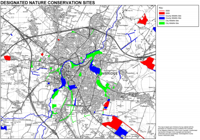
One other CWS (shown in blue above) is likely to be highly affected, and almost certainly destroyed, by the SOUTHERN ROUTE. This is the triangle of woodland beside the existing railway and guided busway, north of Long Road, known as Long Road Triangle CWS. The site qualifies as a County Wildlife Site because of the presence of a Nationally Scarce vascular plant species, Spreading Hedge Parsley (Torilis arvensis), but it is also an important piece of scarce undisturbed woodland in the city. The SOUTHERN ROUTE will require expansion of the existing railway line, destroying this site and its neighbour, below.
Long Road Triangle is given extra value because it joins a City Wildlife Site (CiWS), Long Road Plantation, just south of Long Road. CiWS are designated by the same body as the County Wildlife Sites, and are important urban wildlife refuges. Long Road Plantation qualifies because it is a woodland of over 1ha and has five or more characteristic woodland plant species.
Moving further south along the existing line, which will be widened, the next City Wildlife Site under threat is Hobsons Brook. This has a higher status as a Chalk stream (see above)together with its adjacent habitat. There is a very high risk it will become contaminated by sediment and debris during the building work.
Nine Wells was a geological SSSI, and is a main source for the Hobsons Brook chalk stream. Adjacent to it is Red Cross Lane Drain (TL465547), a CiWS that supports several neutral grassland indicator species in good numbers. Both sites are likely to be highly damaged by the expansion of the adjacent railway line.
Since these sites were designated a new area of high wildlife and public value has developed at Hobsons Park. It has a large amount of wildlife of interest, and is much used by the people of the city. In just one recent visit the author noted breeding evidence of Reed and Sedge warblers, Corn and Reed bunting, Yellow Wagtail, Skylark in large numbers, Meadow Pipit, and a large Black Headed Gull colony, with Common Terns also likely to breed. Hobsons Brook runs through the site. Expansion of the railway and associated works are likely to have a high impact on this important site.
7. Northern Route Wildlife Sites
The only SSSI near to the NORTHERN ROUTE is Madingley Wood, just over 2 km away, but separated from the route by the A428 dual carriageway. Because of this it is unlikely to be impacted by the route works
There is a Roadside Verge CWS south of Knapwell near the A428 crossing that supports populations of Nationally Scarce vascular plant species including Sulphur Clover (Trifolium ochroleucon) and Crested Cow-wheat (Melampyrum cristatum). This site could be damaged or destroyed.
Also along the route is Beach Ditch and Engine Drain CWS south of Cottenham, designated for its wet ditch flora and fauna. Again this could be damaged or destroyed.
Other impacts of the NORTHERN ROUTE are also much less, and are mentioned above.
Kevin Hand MSc MCIEEM May 2021
Independent Ecologist
Vice President, Cambridge Natural History Society
Course Director, ACE Foundation and Stapleford Granary
Acknowledgements
Many thanks to all at Cambridge Approaches, particularly Dr Anna Gannon, Dr William Harrold, Pippa Keynes, Dr Sharon Erzinclioglu and Angela Thompson; the Cambridge Bat Group; and the Cambridge and Peterborough Environmental Records Centre (CPERC).
References
- Hawkesley, R. & Mungovan, R. (2020). Greater Cambridge Chalk Streams Project Report. https://www.cambridge.gov.uk/media/9067/greater-cambridge-chalk-streams-project-report.pdf
- Lea, V. (2020) Is Mink control for ever? Prospects for eradication in East Anglia. British Wildlife 32(3):165-172.
- Sutherland, W.J. & Wordley, C.F.R. (2017). Evidence complacency hampers conservation. Nature Ecology & Evolution 1: 1215–1216.
- Damant, S. & Vine, C. (2006). The Barbastelle at Wimpole. Nature in Cambridgeshire 48: 60-64.
- Vine, C. (2002). A. study of Barbastelle bats at Wimpole, Cambridgeshire, July 2000 to August 2002. Report to Natural England. Available from Natural England on request or directly from the National Trust.